Introduction: Smarter Cost Control Starts with Better Data
Most commercial construction teams aren’t trying to replace surveying—they’re trying to gain better visibility, improve decision-making, and manage cost more effectively.
Across the Southern California projects we support at Aerial Decisions, many General Contractors and Owners are focused on a few key questions:
- Where can we improve efficiency without sacrificing accuracy?
- How do we maintain visibility without increasing cost?
- What tools give us better insight into jobsite conditions?
Both drone mapping and traditional surveying play important roles in answering those questions. When used strategically, they complement each other and create a more complete picture of the project.
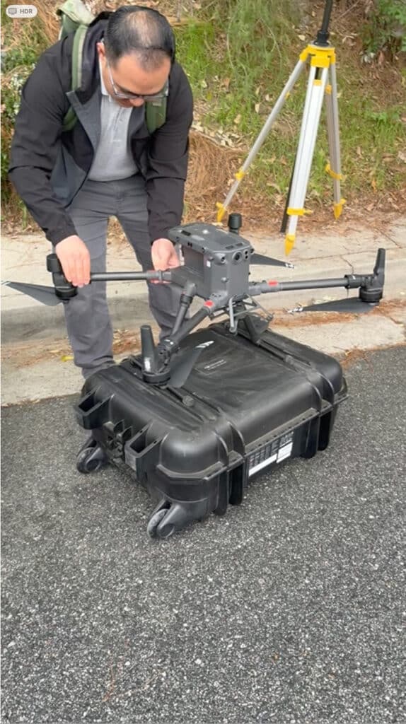
What Drone Mapping Provides on a Construction Site
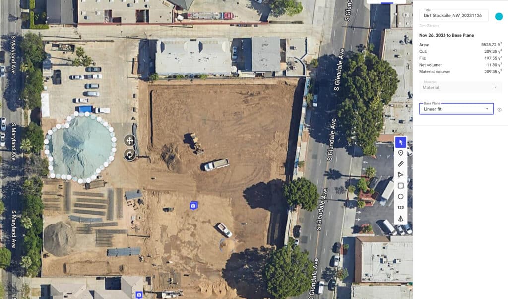
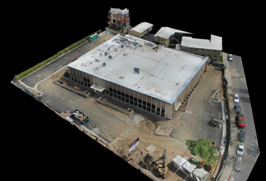
In commercial construction, drone mapping uses aerial imagery to generate measurable site data such as orthomosaics, 3D models, and volume calculations.
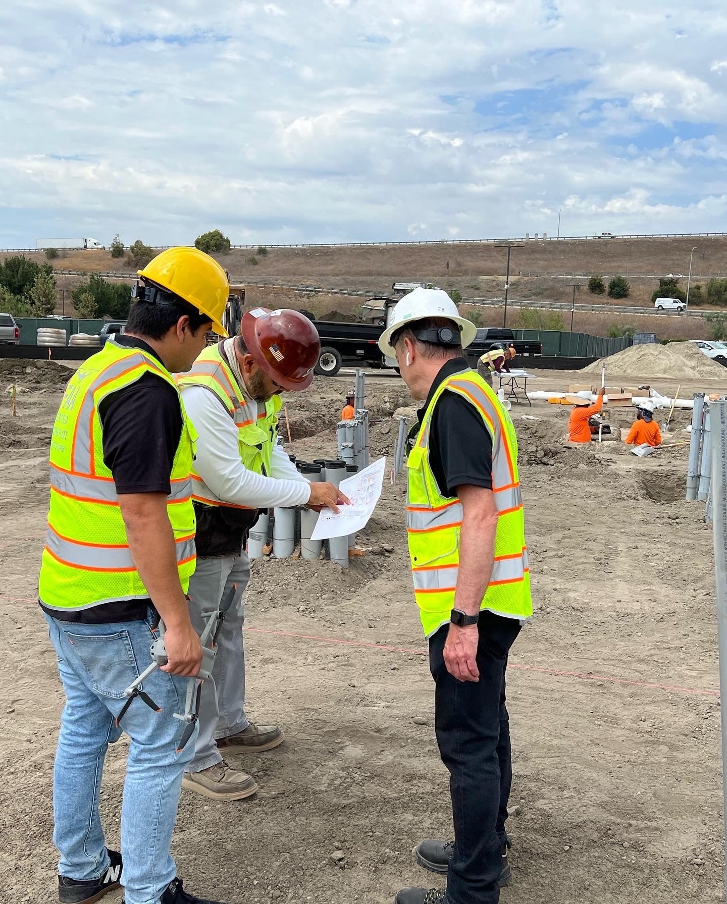
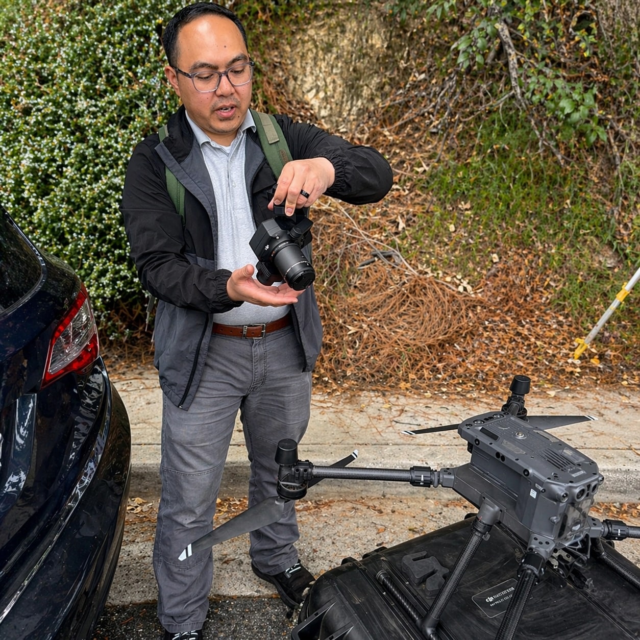
From our experience operating pilot and visual observer crews in the field, drone mapping is most effective when it is used consistently to support:
- Construction progress tracking
- Commercial site documentation
- Volume measurement
- Visual reporting on job sites
It creates a repeatable, scalable way to understand site conditions over time.
What Traditional Surveying Delivers
Traditional surveying relies on ground-based equipment such as theodolites, transit levels for angles, measuring wheels and tapes for distances. GNSS systems help to capture precise measurements (as they do with drone mapping).
Licensed surveyors provide:
- Boundary verification
- Control points and control networks
- High-precision elevation data
- Engineering and design support
- Legal documentation
These deliverables are essential to the integrity of a construction project.
Drone Mapping vs Traditional Surveying: Cost & Value Comparison
| Category | Drone Mapping | Traditional Surveying |
|---|---|---|
| Cost Structure | Lower per capture | Higher per mobilization |
| Frequency | Monthly or weekly feasible | Less frequent due to cost |
| Coverage | Full-site visibility | Targeted measurement points |
| Speed | Rapid capture (hours) | Field-intensive |
| Accuracy | High (project-level) | Very high (survey-grade) |
| Best Use | Progress + reporting | Control + compliance |
Where Drone Mapping Improves Cost Efficiency
From what we’ve seen across commercial construction projects, drone mapping creates cost efficiencies in areas where frequency and visibility matter most.
Reduced Site Visits
Aerial capture allows teams to monitor conditions without requiring repeated field walks.
Faster Data Collection
Large sites can be documented quickly, often within a single flight.
Ongoing Progress Visibility
Recurring flights create a time-based record of site conditions without repeated survey mobilizations.
Volume Tracking
Material quantities and stockpiles can be measured more consistently.
Most teams find that drone mapping becomes a cost-efficient layer of ongoing site intelligence, rather than a one-time deliverable.
Where Traditional Surveying Remains Essential
Even with advancements in drone technology, traditional surveying remains critical to most construction projects.
Licensed surveyors continue to provide:
- Boundary determination
- Control networks
- Engineering-grade accuracy
- Legal documentation
These elements are foundational to project execution and compliance.
Data Accuracy and Professional Use
From our experience working alongside licensed surveyors on commercial construction projects, the most effective approach is a combination of both drone mapping and traditional surveying.
Drone mapping provides accurate, repeatable site data that supports:
- Progress monitoring
- Volume measurements
- Site documentation
- Executive reporting
At the same time, it’s important to be clear:
Drone mapping is not a replacement for licensed land surveying or survey-grade deliverables.
Traditional surveying remains essential for:
- Boundary determination
- Control networks
- Engineering and design accuracy
- Legal documentation
Most projects benefit from using drone mapping to fill the visibility gap between survey intervals, improving both efficiency and communication without compromising accuracy requirements.
Mini Case Snapshot (From Field Experience)
- Project Type: Large municipal road improvement project, Glendale, California
- Challenge: Need for consistent progress visibility without increasing survey costs
- Drone Method: Monthly drone mapping integrated with existing survey control
- Outcome: Improved reporting clarity, reduced need for repeat survey mobilizations, and better alignment between field teams and city engineers
How This Impacts ROI on Real Projects
From our experience, the return on drone mapping is not typically driven by replacing surveying—it comes from improving how teams operate between survey updates.
Most projects see value through:
- Reduced redundant site visits
- Improved communication between stakeholders
- Earlier identification of potential issues
- Faster decision-making cycles
When the right data is available at the right time, both cost and risk are easier to manage.
A Practical Approach That Works
Most successful projects take a blended approach:
- Traditional Surveying: Establishes control, supports design, ensures compliance
- Drone Mapping: Provides ongoing visibility, documentation, and reporting
This allows teams to maintain:
- Precision where it is required
- Visibility where it adds the most value
FAQs
- Is drone mapping cheaper than traditional surveying?
Drone mapping is typically more cost-efficient for frequent site monitoring, while traditional surveying is used for high-precision and legal measurements. - Can drone mapping replace a licensed surveyor?
No. Drone mapping complements surveying but does not replace licensed survey work. - How often should drone mapping be used?
Most projects benefit from monthly mapping, with more frequent capture during active phases. - Is drone mapping accurate enough for construction use?
Yes, for progress tracking, documentation, and volume calculations, it provides reliable project-level accuracy. - Who benefits most from combining both methods?
General Contractors, Owners, Developers, and Project Executives responsible for cost, schedule, and reporting.
Executive Takeaway
From our experience at Aerial Decisions, most commercial construction teams see the strongest results when they stop viewing drone mapping and traditional surveying as competing solutions.
- Drone mapping delivers cost-efficient visibility.
- Surveying delivers precision and compliance.
Used together, they provide a more complete, practical, and financially effective way to manage construction projects.
Disclaimer
Drone mapping and data services provided by Aerial Decisions are intended for visual documentation, progress tracking, and general measurement purposes only. These services do not replace licensed land surveying, boundary determination, or engineering-grade deliverables.
From The Editor:
Do you need to hire a professional drone service provider for your project? To speak to an aerial data specialist, fill out a form, email us or for even faster response times, give us a call at (833) FLY-4YOU or (833) 359-4968. Check out our transparent pricing and watch this space as we expand on the above topics and more over the coming weeks and months.
If you like this post, feel free to click the share button at the bottom of the page. We appreciate you helping us by spreading the content we share on our blog.

Showcase Your Company on the Drones and Construction Podcast! If you’d like to be a featured guest on our podcast, send us an email: info@aerialdecisions.com and one of our crew will get right back to you to share the details.
About Aerial Decisions
Aerial Decisions is a Los Angeles-based Drone Services Provider (DSP). We specialize in providing cutting-edge drone data collection combined with industry leading software solutions tailored for the commercial construction industry. Our mission is to optimize the way enterprise construction projects are managed by offering precise aerial photography, detailed data analysis, and innovative software tools through a network of FAA-certified and insured drone pilots. Aerial Decisions is not just a drone service provider; we are your strategic partner in commercial construction. Our hands-on approach to understanding your unique requirements and our dedication to excellence ensures that every flight and every data point is optimized for your success. Trust us to be the eyes in the sky that elevate your construction projects to new heights.